Friday, 28 August 2015

13th August - Yellowstone National Park, Wyoming - Day Three

Not quite the same early start as the day before, but we were off before sunrise.  The skies too were a lot clearer and the signs were for another lovely sunny day.  Today we were intending to explore the north western part of the park, and we were wanting to get past the road construction just north of the Norris Junction before the traffic builds up.  The road was closed up until 7.00 am so we did still have time to stop off along the way to continue to enjoy the spectacular scenery that is further enhance by the wonderful light at this time of day.

After the road crossed the Madison River and ran alongside it we could see the mist once again hanging over the water, being lit up by the early rays of light.


A little further on Elk were feeding on the banks of the river, the grass though dry and brown, turned golden in the sunshine.


At the junction we turned left and followed the road along side the Gibbon River.  There are several small geysers and hot springs alongside the road, and in the cold morning air, the temperature around 40 degrees fahrenheit , the steam was filling the air like a thick mist on a October morning.


Having passed it several times over the last few days we decided to stop to have a look at Gibbon Falls.  Not as high as the other water falls we have seen, nonetheless it was still impressive.  The water flowing over the harder granitic rhyolite rock on the edge of the Yellowstone caldera.


The road then opens out into wide meadows with views stretching out from both sides of the road, the lush green of the meadow accentuated in the morning sunshine.


As I stood looking out over the open space I could hear honking calls in the distance and then the calls turned into two Sandhill Cranes flying towards me and then overhead and away over the trees.


A little further on where the road goes close to one of the meanders of the Gibbon River there is a terrace of hot springs, and the area was again shrouded in mist and steam creating some lovely landscapes.  The pines appearing from the grey mist.


Tops of mountains floating above the pure white cloud.


By the side of the river a small flock of Canada Geese slowly made their way from me.


Leaving just the river to smoulder and shroud the distant pines.


On reaching the Norris Junction we headed straight on in the direction of Mammoth.  As i mentioned earlier the road is currently under construction, with some major work being carried out.  As a result the black-top has been removed and in places it is just a single carriageway under traffic control.  This meant no stopping which was extremely frustrating as we past lovely clear still lakes with amazing reflections of the surrounding mountains, and the area of Beaver Lakes renowned for the good possibility of both beaver and bear.  Nevermind we could do nothing about it, the positive thing though was the fact we managed to get through easily with out any major hold ups.

Back on the tarmac we decided to stop for breakfast at a turnout next to Willow Park.  Close to the turnout a small creek bubbled along, and other than the odd car passing it was wonderfully silent, and we could enjoy the scenery in peace.


The signs said this was prime moose country, water and a bog being ideal for them, and you can see why.


There were no moose though, instead there was something a little smaller, much smaller in fact but definitely a lot cuter...


A Golden-mantled Ground Squirrel, it is similar to chipmunks in more than just its appearance as it like the chipmunk will hide food in burrows, transporting it in cheek pockets.  It is equally at home in a wide variety of forest habitats as well as rocky meadows, and even sagebrush flats, just what we were finding here

It had no fear of us as it ran along the stone wall finding little titbits to eat, and no doubt it also gets fed by the cars that pull over to look at this idyllic spot, I can tell you that this little guy is quite fond of banana.


Hard to think of anything cuter, but it was not alone there were also others prepared to give it a run for its money.  The better known Chipmunk, or to give it its full name, the Least Chipmunk.


The smallest species of chipmunk they are commonly found in sage bush areas, alongside rivers and in conifer trees, so again all of those ticked here then

They preferred to stay around the trees and if they approached the stone wall they were immediately chased off.


As well as the squirrels and chipmunks there were several songbirds in the bushes, a few White-throated Sparrows and several of these Yellow Warblers.


Tearing ourselves away from the squirrel we continued along the road towards Mammoth.  After a couple of mile the road enters a wide open valley where on the west side there was a large lake, and beyond it the Gallatins Mountain range.  The lake is known as Swan Lake due to the fact that Trumpeter Swans gather here in the winter.  This morning though the lake was home to about 50 Blue-winged Teal that took to the air when we got out of the car.


They circled the lake, back and forth before finally settling back on the water.


The Gallatin range looked quite spectacular in the morning sunshine.


Directly in the middle is Quadrant Mountain, to its left the next peak is Antler Peak, and to the far left, the highest peak at just over 10,000 feet is Mt Holmes.  To the right of Quadrant Mountain at the far edge of the picture are the distant peaks of Electric Peak and Sepulcher Mountain.

We walked down to the waters edge, and had better views of the mountains reflecting in the still clear waters of Swan Lake.


There were one or two birds in the reeds and I think these are Vesper's Sparrows, but they are very difficult to distinguish, the american sparrows being very difficult LBJs.


As well as the sparrows there were several large Dragonflies about as well as a few smaller Flame Skimmers which were hard to pin down and several blue damselflies.  The large Dragonfly is I think, from the abundance of them almost everywhere, a Green Darner, one of the commonest dragonflies in North America.  here two were engaged in a little bonding.


The Green Darner is not only the commonest in North America, but also the largest.  It also conducts considerable migrations moving from the northern states south as far as Mexico and Texas.

As we approached Mammoth there were signs for upper and lower terrace drives, now I confess to not having researched or read much on this area, my main focus being on the wildlife opportunities around the park.  It wasn't until Helen pointed out the picture used on the official park guide and map that we began to realise that this could be a special place.  Nothing was closer to the truth.

We pulled over at a spot just outside Mammoth when we saw some impressive cliffs created by the mineral deposits, looking up they were contrasted with the now beautifully blue sky.


This was the cliff face of the upper terrace of the Mammoth Hot Springs.  Bother the lower and upper terraces are the product of dissolved subterranean limestone called travertine which is continually deposited as the hot spring waters cool on contact with the air.  Travertine often has a fibrous or concentric appearance and exists in white, tan, cream-coloured, and even rusty varieties.


While limestone is base rock of the area, hot water is the creative force of the terraces. Without it, terrace growth stops and colour vanishes.  Even though Mammoth lies north of the caldera ring-fracture system, a fault running north from the Norris Geyser Basin, about 21 miles away, connects Mammoth to the hot water of that system. A system of small fissures then carries water upward to create approximately 50 hot springs in the Mammoth Hot Springs area.


Ahead of us we could see more car parks and board walks leading off around the lower area, so we headed down, parked the car and set off to explore this unique landscape.

According to the guides there is about an hour's worth of boardwalks that lead around the terraces, we started at the bottom passing greyish white limestone, much of this area is dormant at the moment, and has allowed life to begin to colonise the area like this small pine.


As the boardwalk winds its way through the lower terraces dead trees with bleached bark dominate the lower area.


While the terraces themselves are fascinating the major attraction for us were the colours and patterns the deposits and bacterial mats produce when looked at closely.  The colours are produced mainly by the bacteria and algae that flourish in the warm waters..


The first main terrace we came upon was Jupiter Terrace, a series of steps down with cascading, steam water.  In the 1980s this flowed so much it covered the boardwalks, now just a trickle


In amongst the steam Violet-green Swallows, identifiable by the white patches on thee side of the thighs, flew, and some seemed to even be nesting in holes in the terrace cliff faces above the rising steam.


The boardwalk winds its way below the Main terrace, looking up you can see how the cliff has formed.


Steps lead up to a viewpoint over the main terrace and you can look south across towards Canary Springs, and the Upper Terraces.


Or north towards Mammoth and the Gardiner River Valley away in the distance.


Across the terrace dead trees emerge from the rock, and in places at their base new life is emerging, the trees having been killed by the initial advance of the hot water, the grasses growing as silt and dust gather on the exposed rock.


The boardwalk winds around to an overlook where you can get up close to the patterns in the water.


And the smaller terrace steps give an indication of how the whole area has formed over the millions of years.


Finally the boardwalk ends at Canary Spring, so named for its bright yellow colour, Canary owes its brilliance to sulphur dependent filamentous bacteria. The colours blend here in delicate tints on the creamy rock face.


From the Hot Springs we took the time to walk around Mammoth which was formerly known as Fort Yellowstone up until 1918, this was when the army managed the park.  Many of the building emanate from then, and the manner in which they are laid out is completely different from the other settlements in the park.  In fact this one seemed to completely compliment the surrounding countryside, the building colours reflecting the same colours as the rocks and vegetation, it was also immaculately clean.  Many of the buildings were stables, a granary and even a jail.  Today they are used for employee residences. 

From Mammoth we headed north the short way to the park entrance, stopping to take in the surrounding cliffs.


And the Gardiner River that winds its way through them,following south from the town of Gardiner to the Yellowstone River


But then we decided to turn back and head off east along the road to the Tower-Roosevelt Junction, this took us high over the Gardiner River Bridge, and then followed the river past several water falls, one of which was the Udine Falls a three stepped falls.


The road continued through Pine forests until the valley opened up and we had views of the Blacktail Ponds where we pulled over.


A trail led down alongside the pools, so I headed down to get a better view of the water and its inhabitants, Helen preferred to stay with the car to watch the valley.

There were several family groups of Lesser Scaup, with varying ages of ducklings.


Darner Dragonflies were hawking over the water, and in the reeds was a Brown-headed Cowbird.


To the far end of the pond was a group of Blue-winged Teal, but the ground was too marshy to get close enough.  I turned back and disturbed a Ruddy Duck from close to the bank.


Helen called from the car to say that she had picked up a small group of Pronghorn coming down the side of the valley towards the water.


I watched them as they slowly made their way towards the ponds.  The group was led by a female, with a male lagging far behind.  Their approach was very careful, with them continually stopping to look around to see if it was safe to continue.

I started to make my way back up to the car, stopping to photograph a yellow butterfly.


I think this is a Pelidne Sulphur, a butterfly found more in Canada, but that also extends into Montana and Wyoming.

Back at the car we watched the Pronghorn come closer and closer, and they were clearly coming down to drink.  Finally the group climbed down the ridge and found a spot of water. The leading female though did not join them, staying on the ridge watching.


The male kept coming and walked through the group to drink, and then once finished started to check out the females!

Leaving the ponds we turned off the main highway onto the Blacktail Plateau drive.  This was a one way gravel road, and to be honest did not produce anything really different.  We passed a lone Bison.


And at the highest point there was quite a spectacular view north.


Apparently in early summer the area is awash with the colourful flowers, and from September there is a lot of autumn colour, we had arrived in between these two seasons.

Re-joining the main road we decided to stop for lunch at The Roosevelt Lodge, the lodge being named after Theodore Roosevelt who visited the park in 1903.As we ate lunch on the porch of the general stores we were joined by yet another ground squirrel, this time it was a Unita Ground Squirrel, this one like bread.


It was now hot, the temperature into the low nineties.  We decided to drive through The Lamar Valley once again, not expecting to see that much, but just to get the chance to see it in the sunshine, something we didn't manage yesterday.


There were small groups of Bison in the valley, but nothing like the activity we saw yesterday morning.


Mid afternoon is not the best time in the park, its hot, the animals retreat to cooler places, and the amount of tourists increases significantly.  We decided to make our way back to West Yellowstone, we were leaving the next day o go east, so it would give us time to get organised, however there was one more surprise left in the day, as we wound our way through the mountains the traffic slowed due to three Bighorn Sheep by the side of the road, while they were not the impressive males with the big horns, it was nice to see a female, and quite close up.


The rest of the journey took us through what by now had become familiar landscape, and then back to the hotel.  Our journey tomorrow would allow us time to explore an area we hadn't done properly yet, the Geyser Basin, and then away to the eastern part of the park, and out to Cody.  After sorting ourselves out, it was time for dinner and then an early night, because we wanted an early start, the best time of the day in Yellowstone Park.

Wednesday, 26 August 2015

12th August - Yellowstone National Park, Wyoming - Day Two

Up at 5.00 am, away by 5.30, we headed back into the park not expecting to encounter much traffic, but ended up behind a low rider carrying construction equipment.  The road from Norris to Mammoth is under construction, and closed overnight, and this truck and trailer was headed there.

The sun does not rise until around 6.00 am, so it was dark as we followed the truck to the Madison Junction, but after that I was able to get past it, and we were able to move a little easier.  We were heading for the Lamar Valley, another area of open grassland that is considered to be the top wildlife viewing spot in the park.  Early morning is the best time to be there, as there is always the chance of seeing any of the big animals at that time.  It is though, at least 50 - 60 miles from the west entrance, so with a speed limit of 45 mph the early start was essential.  The weather though was a little disappointing with overcast skies, but a little warmer than the day before.

To Norris the road follows the Gibbon River, opening out in places to wide lush meadows, and then past steaming sulphur geysers.  From Norris we headed east to Canyon Junction where we turned north, past Mount Washburn, and over the Dunraven Pass at 8,859 feet, and then down towards Tower and the Roosevelt Junction.  As we came over the pass the sun was rising, and red light was making its way through the gaps in the cloud.


At the bottom of the valley is Antelope Creek, and the area is a prime Grizzly Bear site, but needless to say we never saw any sign of a single bear.

At the Junction we turn right and into a initial hilly landscape that consists of several kettle ponds, small lakes formed by the glaciers, but after some winding turns the road joins the mixed sage and grasslands of the Lamar Valley.  This is home to large herds of Bison, and Elk, along with the Pronghorn Antelope, but the bigger attraction is the possibility of seeing one of the several wolf packs that have set up territories.

However it was the Bison we first encountered close to the side of the road.


Feeding in the grass around the Bison were juvenile Cowbirds.  They pick up the seeds the Bison disturb as the make their way through the grass.


The rutting, or mating, season lasts from June through September, with peak activity in July and August. At this time, the older bulls rejoin the herd, and fights often take place between bulls. As we pulled over and I got out of the car, you could hear the grunts of the male Bison, as they pursued the many females.


Many of the females had young calves with them, and many of these had to move away as the older males moved in.


The herd we were watching was very restless, something that is encountered during the breeding season. The animals appeared belligerent, and possibly unpredictable, this is known as the time when they can be at their most dangerous.


It appeared that head dress was the fashion of the day, several bulls wearing flowers behind their horns and ears.  They probably picked them up while scraping the ground.


Some of the males could be seen wallowing on the ground in the dirt. 


 A bison wallow is a shallow depression in the soil, either wet or dry. Bison roll in these depressions, covering themselves with mud or dust. One of the explanations suggested for wallowing behaviour is a grooming behaviour associated with male-male interaction (typically rutting behaviour).


Some of the large bulls moved about the females, snorting and scrubbing the ground with their horns.  The Cowbirds stayed close in these situations some taking the opportunity to ride the Bison's backs in a manner similar to the ox-peckers in Africa, but for different reasons, the Cowbirds looking to pick up the seeds not ticks on the animals


Other bulls were sticking close to their chosen females.


We moved on but there were plenty of Bison now crossing the road, and slowing the traffic down to a crawl, as the number of cars increased as the morning wore on.  The bulls were not going to be moved as the strode defiantly along the middle of the road.


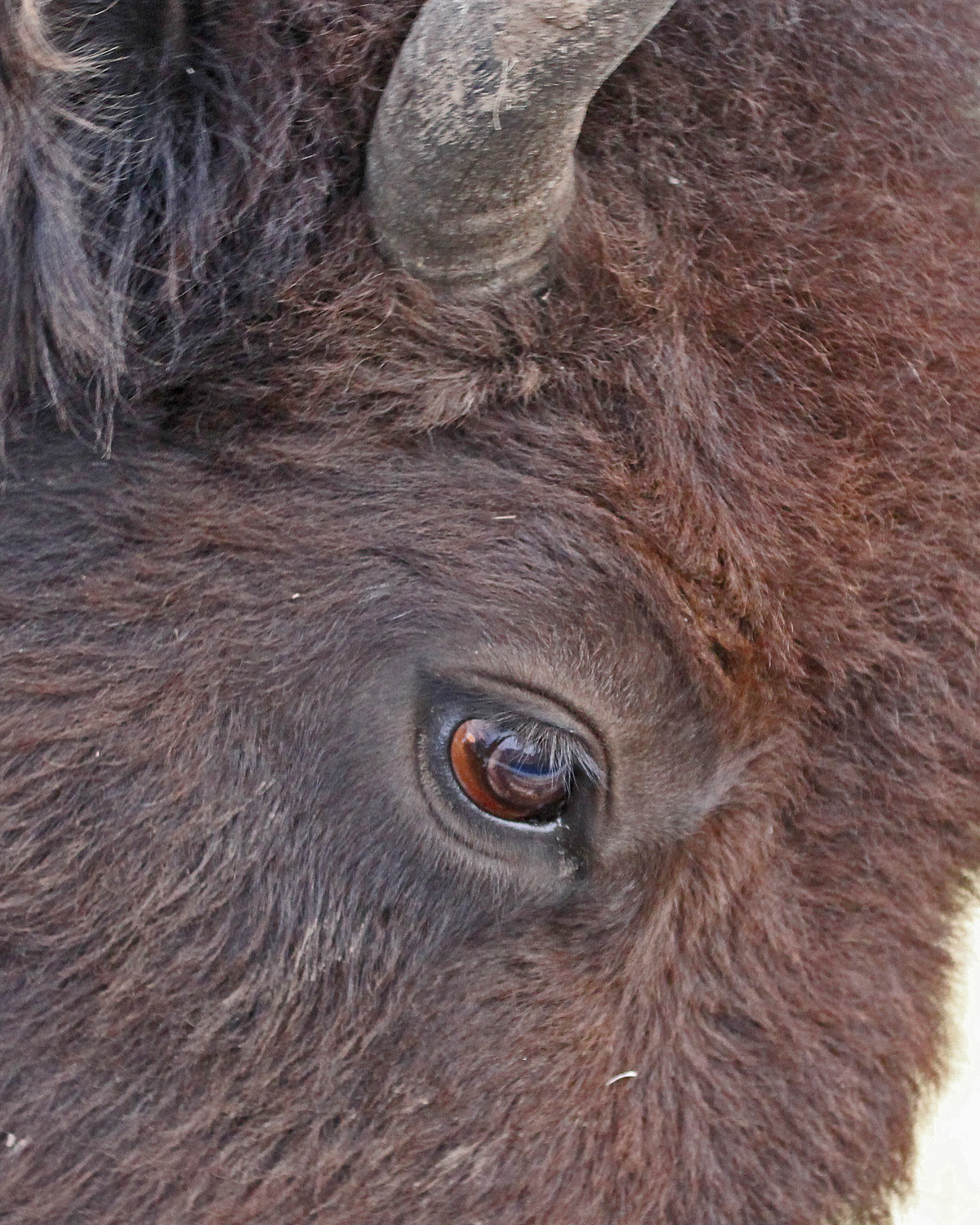
With animals on both sides of us it did give the opportunity for some close up shots of these impressive animals.  There is a certain look of sadness in the Bison's eye.


And a majesty when the animal is seen head on.


Among Native American tribes, especially the Plains Indians, tribes of which moved through these lands, the Bison is considered a sacred animal and religious symbol.  The creation stories of where buffalo came from put them in a very spiritual place among many tribes. The buffalo crossed many different areas and functions, and it was utilized in many ways, not just as meat. It was used in ceremonies, as well as to make tipi covers that provided homes for people, utensils, shields, weapons and parts were used for sewing with the sinew.


We finally managed to get past the Bison on the road, and headed on to one of the turnout spots that overlooks the valley, and the Lamar River.


Here Bison could be seen feeding on the open grassland, and wading across the shallow river.  We scanned the distant hills and forest edge for signs of anything else, but we were not lucky, Helen did though find a small group of Pronghorn Antelope lying down on the top of a rock ridge, our first encounter with this species.  Though not an Antelope it is sometimes known as an Antelope because it closely resembles the antelopes from the old world, and in fact behaves in a similar way.


As we scanned the area we had breakfast, but once we had finished moved on, the number of cars was increasing once again.  A little further along the road, a Yellow-bellied Marmot ran across the road and away across the sage from us.

The road turns away from the Lamar River and into Soda Butte Canyon, following Pebble Creek.  The canyon takes its name from Soda Butte, which is the cone of the only thermal feature in the north east corner of the park.  Just before we passed the butte we noticed many cars parked along the road and in a turnout.  Down below in the valley people were gathering on a bluff above the creek.  Rather than carry on to the park exit we decided to turn around and check what all the fuss was about.  Parking was limited but I managed to find a spot.  We changed shoes and with telescope as well as the usual camera and binoculars we set off to cross the creek and make our way to the view point.  We were told that there were wolves in the area, so we walked along not knowing to be excited or not.

When we reached the view point there were quite a few people present, and we were told the area to look in.  Apparently the wolves had drifted away into the after having fed on the remains of a kill, however one or two were still returning.  We stood and watched, then a black mark appeared that through the scope you could clearly see to be a young Wolf cub.  The photo shows only the location and the smudge, but please believe me it was a Wolf.


We watched using binoculars and the scope, and were finally rewarded by a second animal, this time a definite older and grey Wolf that joined the young one.  Both gave clear views, but unfortunately only through the scope, and were not close enough for my camera.

When Yellowstone National Park was created in 1872, Grey Wolf populations were already in decline in Montana, Wyoming and Idaho. The creation of the national park did not provide protection for wolves or other predators, and government predator control programs in the first decades of the 1900s essentially helped eliminate the Grey Wolf from Yellowstone. The last wolves were killed in Yellowstone in 1926. After that time, sporadic reports of wolves still occurred, but scientists confirmed that sustainable wolf populations had been removed and they were absent from Yellowstone during the mid-1900s.

 In 1995, Grey wolves were first reintroduced into Yellowstone in the Lamar Valley, and numbers peaked in 2007 at 171 individuals in eleven packs.  In 2009 the wolf was removed from the endangered list and could now be legally hunted.  In 2013 there were estimated to be just under 100 wolves in the park with 10 active packs.  Wolf population numbers are subject to natural fluctuations but although wolves within the park boundaries were still fully protected, wolves that ventured outside the boundaries of the park into Idaho or Montana can now be legally hunted. During these hunts, Montana hunters legally killed a number of wolves in the Absaroka-Beartooth Wilderness known to frequent the north-east corner of the park.

We were very lucky to get the views we did, and after a further wait we decided that was as good as it would get so we headed back to the car.  We headed back to the Roosevelt junction, and then left towards Tower where we were able to get a cup of coffee.  

Just before the Tower Junction there is the Calcite Springs overlook which provides views of the Grand Canyon of Yellowstone in an area called the Narrows.


In the picture you can see the vertical basalt columns that were part of a 25 foot lava flow that covered the area 1.3 million years ago, and below that are glacial deposits, the lava having exploded through these.  Above the basalt columns is volcanic ash that was deposited from the same volcanic action that produced the lava.


The Yellowstone River has then cut through the area revealing the past.


We finally reached the Tower General Stores where we were able to get our coffee.  We had passed through here earlier and the car park was empty, as we pulled in now the area was full of cars.  After coffee we then walked to the Tower Falls overlook.  This is where Tower Creek falls over 130 feet down into the Yellowstone River.


The Falls get their name from volcanic towers that surround the falls, that make it look like a fortress, and has earned the name Devil's Den.


We were then back on the road, and joining the many vehicles that had now appeared in the park.  Despite the fact it was only 19 miles to the Canyon Junction it took some time in the traffic.  Driving past the junction we turned off onto the North Rim drive, stopping at the first view point, at the brink of the Lower Falls.  Looking down you could see the falls.


From here we walked down to a viewpoint where it was possible to get closer views of the falls, and views down the valley.


The sides of the valley covered in a yellow ochre coloured rocks


Where the water was creating spray this was covering the sides of the valley, and from the green patches you could see the reach of the spray.


The walk back up was an effort in the altitude, we decided to turn off and walk the North Rim Trail.  Gaps in the trees revealed views of the spray being generated by the Upper Falls, again the spray generating vegetation on the sides of the adjoining rock.


The trail abruptly ended and we were not able to reach the Upper Falls, so we headed back, and then from there we continued along the drive, pulling over at the Lookout Point for further views of the Grand Canyon of Yellowstone.


In a way we were fortunate that the sky was overcast, and sometimes there was even rain, as the colours in the rock were not washed out by the midday sun.  The reds, and yellows contrasting with the greens of the conifers.


It was here we encountered a father and his sons, the boys could not have been more than three or four years old, and they looked quite perplexed when they were told by their father that he had not heard any of them pointing out any hydro-thermal activity in the area!

Looking back towards where we have come from you could see the Upper Falls away in the distance.


The last view point was tantalisingly called Inspiration point, you descended a few steps, but unfortunately the final two were closed as the area was still eroding.  From here, further views along the canyon, and the one piece of wildlife that was always present where people gathered, the Raven.


The North Rim Drive then carries on through the Lodgepole Pines, and comes out at the Canyon Village.  We took the opportunity to have lunch here.

The weather conditions had been overcast for most of the morning with some rain falling in places, so we decided to head south through the Hayden Valley towards the Lake.  As we approached there were signs of blue sky to the southern shore of the lake, but as we crossed the Fishing Bridge it was still raining slightly.  We passed the camp sites and through a wooded are, coming out into the open at a place called Pelican Creek.  We drove across the bridge and pulled over to scan the marsh and grasses that surround the creek as it meandered down to the lake.  This apparently is a good place to spot Grizzly in the spring time.


Looking across to the lake I picked out three American White Pelicans on a sand bar in the water, so we decided to head back across the bridge to the car park where there was the start of a small trail that led down to the lake and beach.

The trail wound its way through a small copse of pines, and then across a marshy piece, emerging on the beach.  We walked down to the waters edge to get a better view of the Pelicans.


The sand bars apparently appear when the water in the lake is low, and there were plenty of other signs of low water, with pools showing along the beach.  There were five juvenile Franklin's Gulls in the water.


Plus an adult Ring-billed Gull that was dancing through the shallow water in order to disturb the mud, and hopefully a meal.


Two more Pelicans flew in, circling the sand bar before dropping from the sky using their large webbed feed as air brakes to perform a perfect landing.


There was also the obligatory Ravens on the beach foraging close to the shoreline.  We turned and made our way to the edge of the trees.  The bank here has been eroded away by the water, and as a result many trees have fallen and died, the wood being bleached white by the sun and the water.  Another Pelican was fishing just off shore, plunging it enormous bill it the water, and then lifting its head high as it squeezed out the water, while hopefully leaving something to eat.


There were calls from the top of the trees that I thought could be Jays of some sort, but then one of the owners flew down to one of the fallen trees, and made its way to the water to drink.  Similar to a Jay and a member of the crow family this is Clark's Nutcracker.


Like jays the Clark's Nutcracker caches seeds for later consumption, and is in fact crucial to the survival of the Whitebark Pine, a tree seen in the area.  This Pine tree is in decline due to rust infections and beetles, the Nutcracker is playing an important part in that recovery with the two very dependent on each other.  No Whitebark Pines no Clark's Nutcracker in the area.

The weather had now changed with blue skies and sunshine, looking along the beach to the east you could see clearly the Absaroka Mountain range.


We started to make our way back to the trail, stopping again though to take in the views over the creek away to the distant mountains.


There had been the calls of a young Bald Eagle, and I had managed to find a brown shape in one of the distant pines that looked like a juvenile bird, but as we reached the car and I scanned again I picked out a distant adult bird at the top of a pine, the white "bald" head clearly visible.


In contrast to the early view we had of the creek, now, with the sun out, and a very blue sky it looked quite spectacular.


This had been a lovely spot, and we had managed to escape the crowds and cars, but now it was time to make our way back.  It was mid afternoon and the peak time for vehicles in the park, and on the journey back through the Hayden Valley we were brought to a stop in queuing traffic on several occasions.  For some the Bison were the attraction and they did not care if they blocked the cars to get the views, for us we were beginning to get quite annoyed with the Bison.

Leaving the Hayden Valley we drove alongside the Yellowstone River, and Helen called for a Dipper on one of the rocks in the river.  I pulled over, and walked back to see if I could get a good view, I could make out the bird but it was difficult to photograph.  Then from the other side of the river two Red-tailed Hawks came out of the trees and circled above the river calling.


The journey back passed though areas of cloud again, and then back into sunshine as we approached the West Entrance, however we were pulled up about a couple of miles from the gate in a traffic queue due to an accident that had happened just on the park side of the gate, two cars, somehow hitting each other front on, it was quite a mess but thankfully we found out later that no one was hurt.  Once past the gate it was back into West Yellowstone and the hotel, and dinner.